The
early novels were set in the Scottish Borders but in 1820 Walter
Scott published 'Ivanhoe', a story that marked a change from his
previous work in both tone and setting. The book described a
semi-fictionalised 12th century England through the
romantic tale of dashing knight Ivanhoe, son of Cedric of
Rotherwood..
The
geographical setting of the novel lies to the east of Sheffield at
Rotherwood, extending northwards to Conisborough and south to the
woods of Nottinghamshire.
The
present day Conisborough, which appears in the book as
'Coningsburgh', honours this connection in the names of streets and
public buildings including an Ivanhoe Road and a Cedric Avenue.
How
much the presence of Rotherwood Hall or the adjacent Orgreave Hall
influenced Scott's choice of location for the family at the centre of
the story I can't discover but the description of the approach to the
hall, through woods, marsh and over streams, does match the actual
topography.
What
is certain however is that the rural landscape of 1820 was about to
change dramatically with the Industrial Revolution and the
exploitation of the local coal resources . Rotherwood, Orgreave and
the village of Treeton took on a very different appearance.
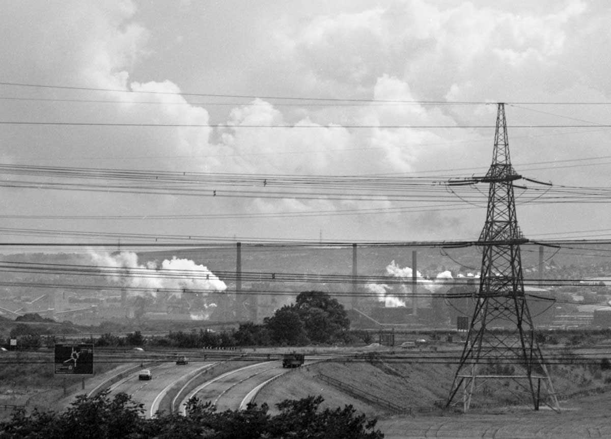 |
| Looking towards Orgreave from Junction 33 of the M1 in 1980 |
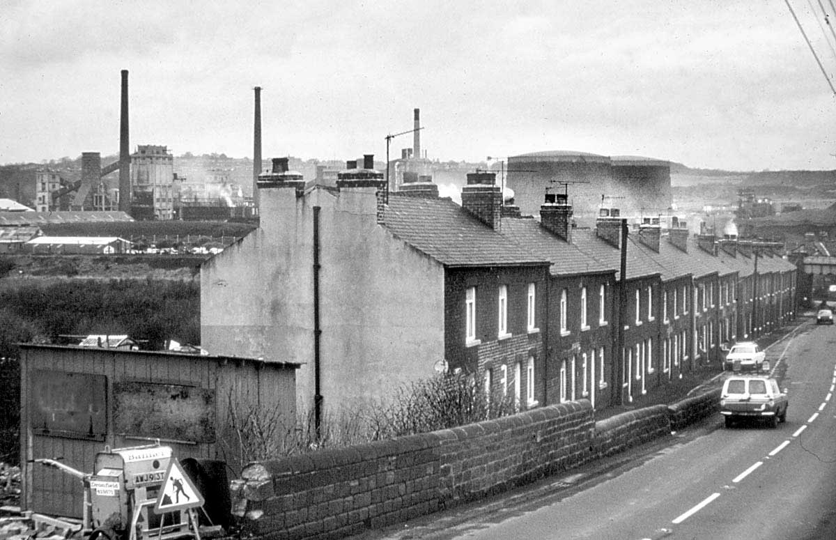 |
| Station Road in Treeton in 1981 with the Orgreave Coking Plant to the left of the picture. From a Kodachrome transparency. Photographer unknown. |
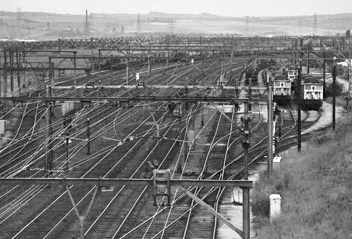 |
| Rotherwood from Orgreave Lane 1981. The marshalling yard assembled coal trains, many of which were destined for the power stations of Lancashire via the electrified Woodhead line. The yard and the electrified line was closed in 1981 shortly after this picture was taken. Although a railway line still runs through this spot, no trace of the yard remains. |
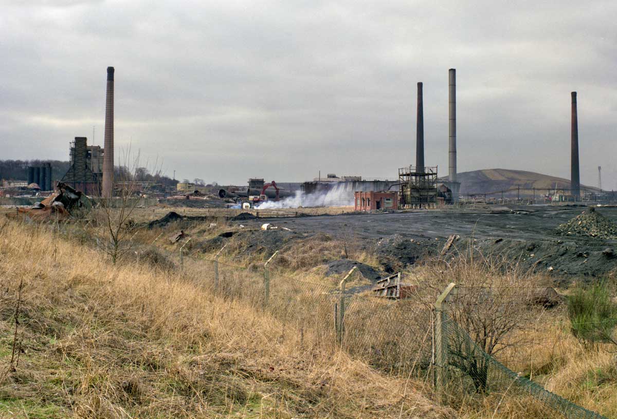
While
Sheffield is rightly known as 'Steel City' for the industry of the
Don Valley, in the eastern suburbs the economy and the landscape has
been shaped by coal production. In 1980, to a driver on the M1
motorway looking over to the Rother Valley, Sheffield had the
appearance of a coalfield city. There were still pits at Treeton and
Orgreave and Beighton and Brookhouse, and the landscape was dominated
visually by the Orgreave Coking Plant that supplied coke to the blast
furnaces at Scunthorpe and gas to the Templeborough steelworks at
Rotherham. Rotherwood Hall and Orgreave Hall were both within the
Orgreave site and used by the NCB as administrative buildings.
I
visited the site in the 1980s but my notes and most of the negatives
from that occasion are lost. My memory is that it was before the
miners' strike of 1984-5 but I can't be sure.
Be
that as it may, my surviving negatives show that my focus was on the
environmental aspects of the area. I was visiting with an academic
who was researching the ability of vegetation to recolonise spoil
heaps so perhaps that was to be expected.
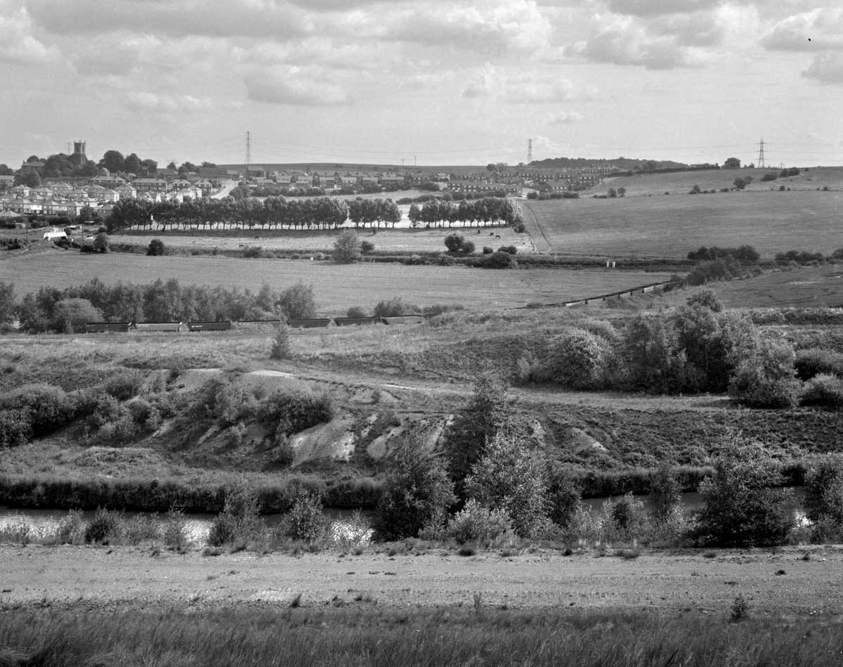 |
| Looking from the Orgreave spoil heaps towards Treeton village. circa 1984. The River Rother has now been diverted at this point |
 |
| Looking from the spoil heaps to the coking plant. circa 1984. |
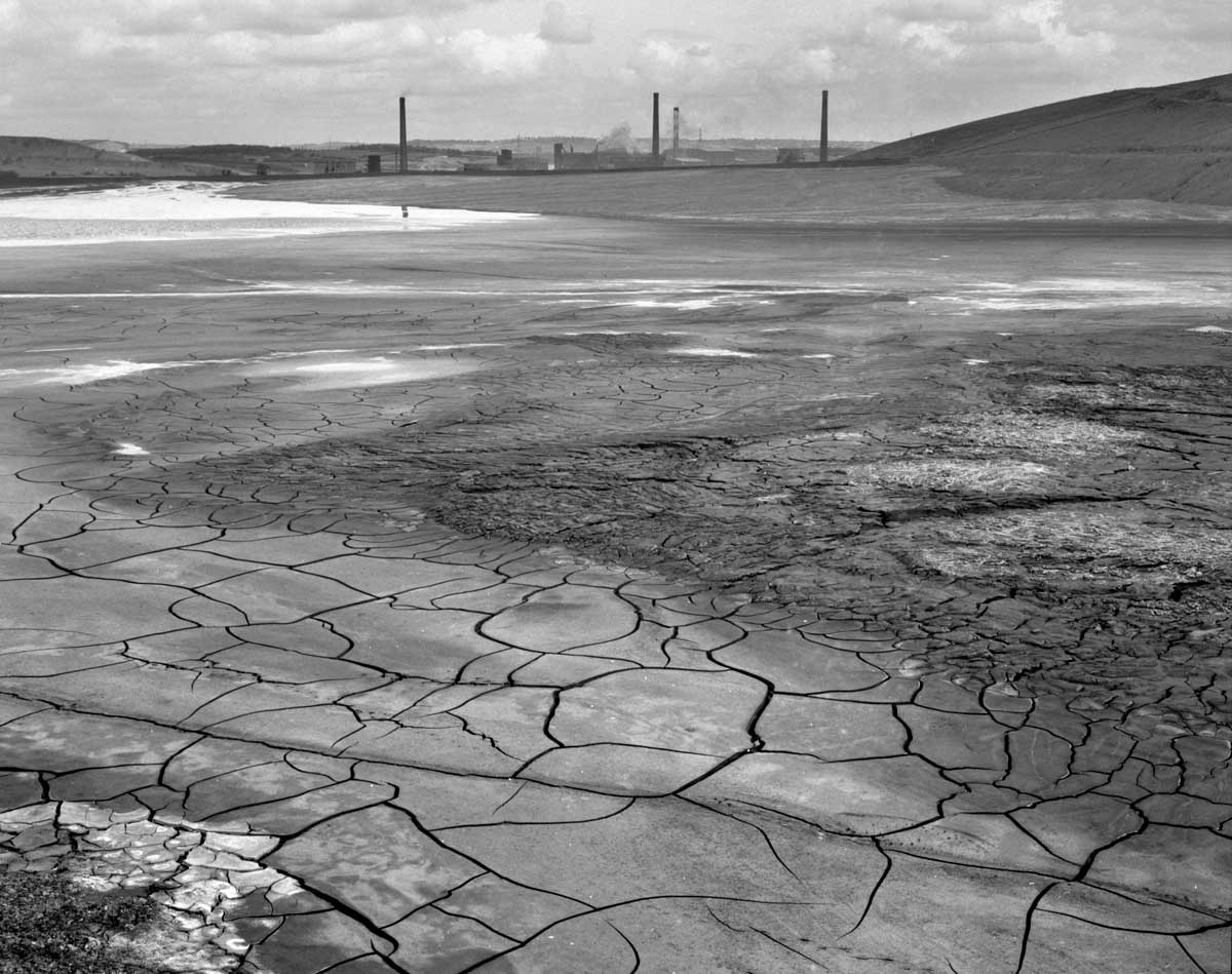
At
the time the Rother was one of the most polluted rivers in Europe,
not just from the Orgreave complex but from the collieries and the
Coalite plant upstream. Since that time the river has been diverted
at this point and and the demise of the coal industry has allowed for
a much cleaner waterway. In 2017 the river was stocked with 18,000
grayling, a fish that had once been plentiful in the river but which
pollution had exterminated locally.
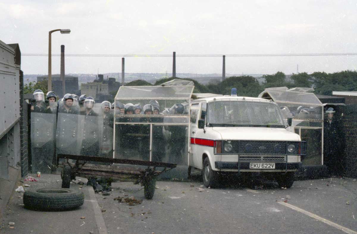
But
the history of the area changed again with the miners' strike of 1984
and what became known as the Battle of Orgreave. The story is well
known but, very briefly, June 18th 1984 saw a stand-off
between miners' pickets and a large force of police. At the end of
the afternoon baton wielding mounted police were ordered to charge
miners who were gathered in a field to the south of the coking plant
"It was",someone said later, "a riot. A police riot". The
miners were chased onto the railway line that ran behind the field
and up into the houses on Rotherham Road.
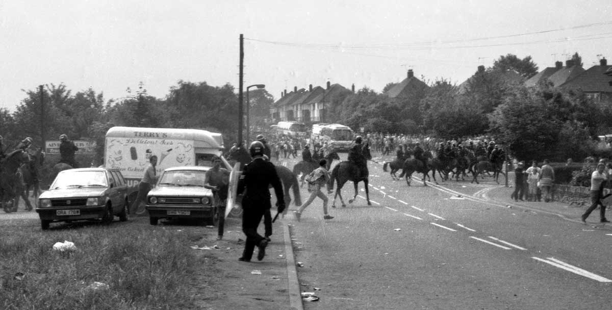 |
| Rotherham Road on the afternoon June 18th 1984. The police horses are driving the miners up Orgreave Lane towards Handsworth. Photograph: Lesley Boulton. From a Kodachrome transparency. |
This
image is from a 35mm slide by Lesley Boulton who was there as a
member of Women Against Pit Closures and as a freelance. She,
herself, became an iconic figure in the photographic representation
of the day as the figure attending to a fallen miner while a charging
mounted policeman, baton raised for a blow, bears down on them.
After
the strike the run down of the coal industry continued. Orgreave
colliery, Treeton colliery and Orgreave coking plant had all closed
by 1990/91.
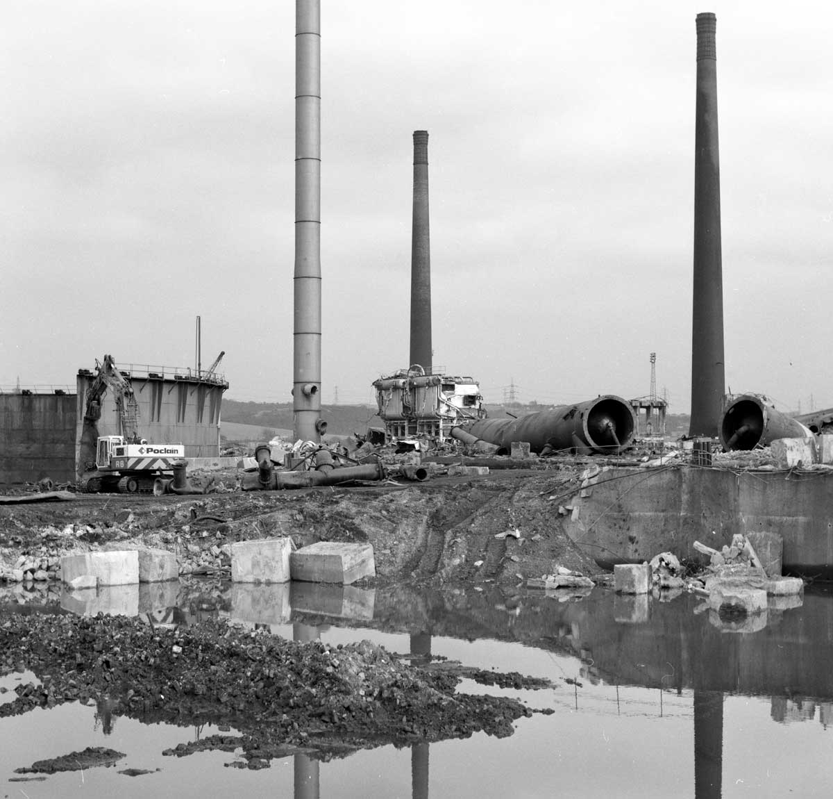 |
| The Orgreave site during demolition in 1991. |
 |
| The Orgreave site during demolition in 1991. |
The
coal industry was privatised in 1994 and UK Coal opencast mined the
area for about ten years. Then, in the early 2000s, Harworth
Estates, the property development arm of UK Coal, announced their
intention to build a large housing complex on the site and at the
same time, just to the west, Harworth and various partners were
developing an Advanced Technology Park, partly on the site of the old
High Hazels colliery.
The
name chosen for the housing development was Waverley and my immediate
thought was that it was a reference to Walter Scott , an appeal to a
romanticised time of Richard the Lionheart, Robin Hood and Ivanhoe
himself , thus losing not just the name of Orgreave but also any
reference to a recent past.
I
can find no official explanation for the choice of name but High
Hazels colliery was operated by the Waverley Coal Company and a
Waverley Lane leads to the former site. Whether the coal company was
another institution that took its name from Scott's novels I can only
speculate.
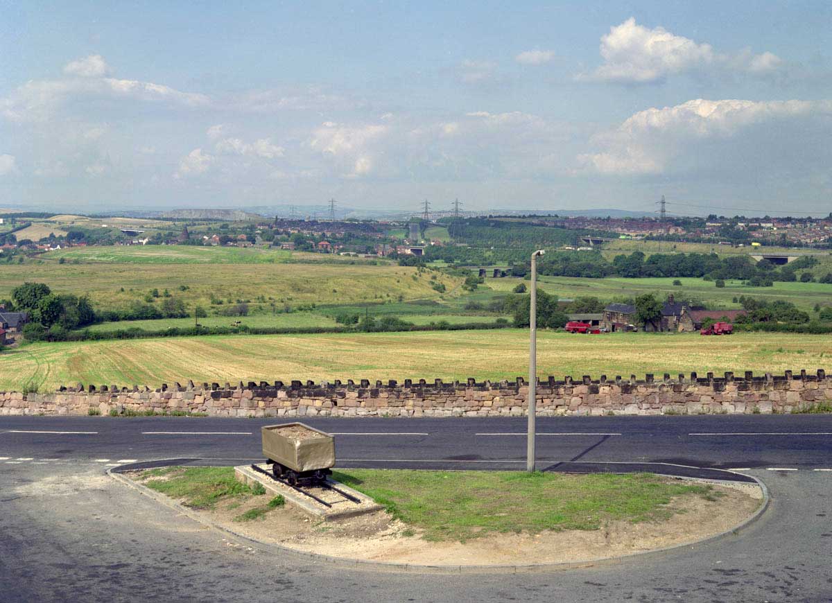
So
how is the recent past visible in the landscape? In 1992 I
photographed the entrance to Treeton village where a pit tub had been
plinthed as a reminder of the colliery that had closed two years
before. It looked a little forlorn at the time though properly
respectful.
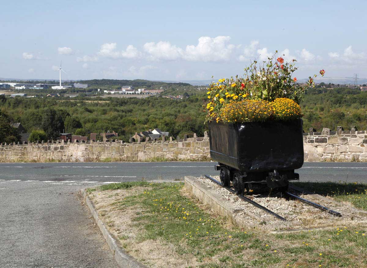
A
recent visit (August 2018) showed it well maintained and full of
flowers. It wasn't possible to frame the image to replicate the 1992
camera position because of vegetation growth on the site but the
photograph shows the care that has been taken with its upkeep.
 |
| Treeton village. 1992. |
 |
| Treeton village 2018. |
Harworth
Estates have a feature wall at the entrance to the development that
is formed of steel uprights, allowed to rust, and stone walling with a band of
slate that is meant to represent
a coal seam . It is more a reference to geology than mining.
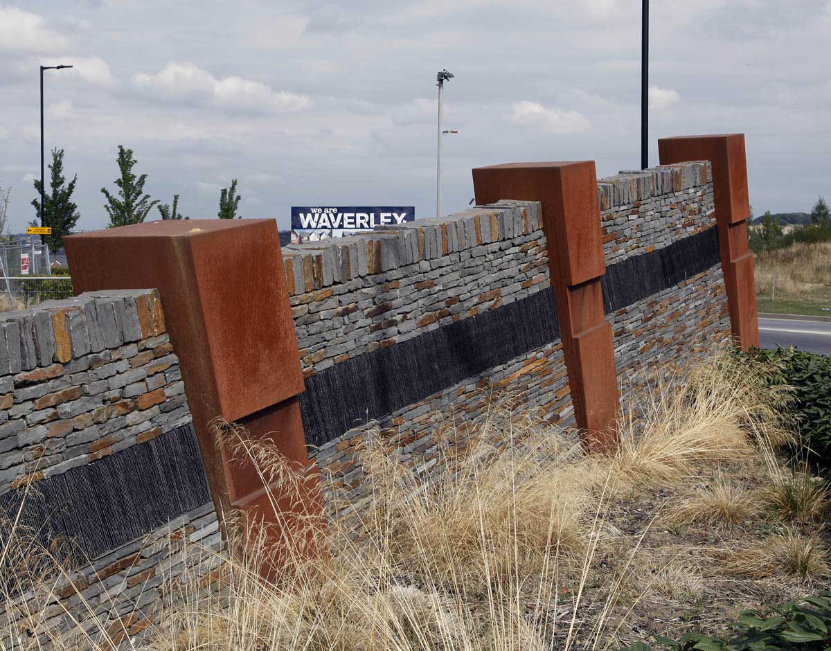 |
| The feature wall at the entrance to Waverley. |
Overlooking
the site is a sculpture representing a miner underground, the prone
figure emerging from the surrounding rock. It carries a plaque
reading "Dedicated to the workers of Orgreave Colliery 1851-1981"
It's certainly an image of struggle (to extract the coal).
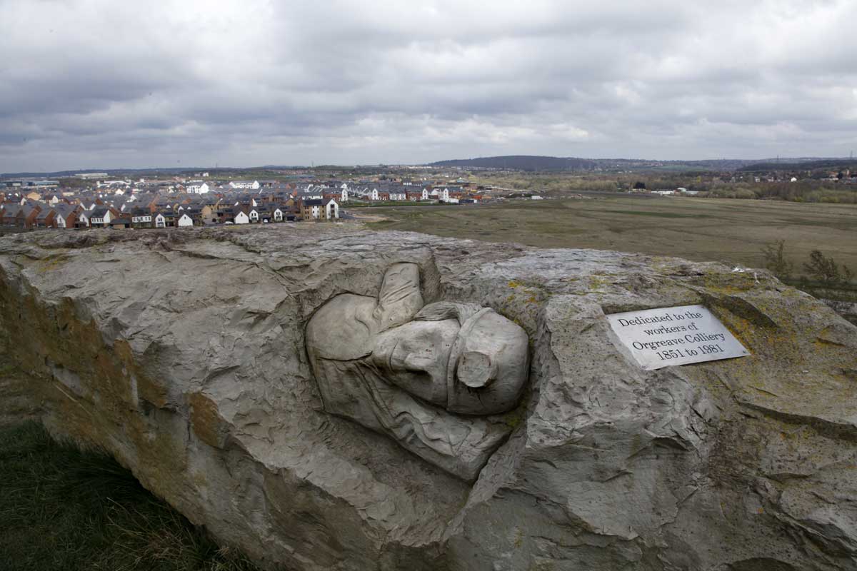 |
| The sculpture above the Waverley site. 2019. |
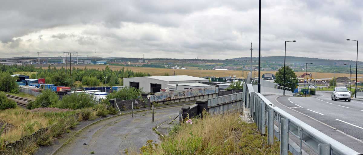
Undoubtedly,
though, the most live expression of recent events and memory is the
bridge over the railway on Highfield Lane. It's been by-passed now by
a new bridge installed as part of the Waverley changes to the roads.
In 1984 it was the scene of a stand off between police and pickets.
It was recorded by the press corps and is another iconic image of
the strike. Mine, reproduced here, is another from a transparency by
Lesley Boulton.
The
bridge is still the locus for feelings about the strike and since the
25th anniversary of the Battle of Orgreave, every June
18th, Anne Scargill and members of Women Against Pit
Closures place flowers and ribbons on the new bridge.
 |
 |
| The bridge in 2009 on the 25th anniversary of the Battle of Orgreave. The new bridge is on the right. |
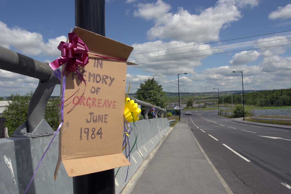 |
| Flowers and ribbons on the 25th anniversary |
 |
| The view from the new bridge, 2018. |
The
street names on the Waverley estate largely reference Sheffield's
Golden Frame, the hills and valleys of the Derbyshire countryside-
Whirlow, Bakewell and Matlock among others. One name that appears is
that of Sorby. The Sorby family owned both Rotherwood Hall and
Orgreave Hall and became prosperous coal producers and edge tool
manufacturers. The northern end of the site is being developed as
Sorby Village, marketing strapline- "Dare to be Different"�.
Over
at the Advanced Technology Park the road names celebrate , among others, Whittle, Wallis,
Morse, and Brunel.
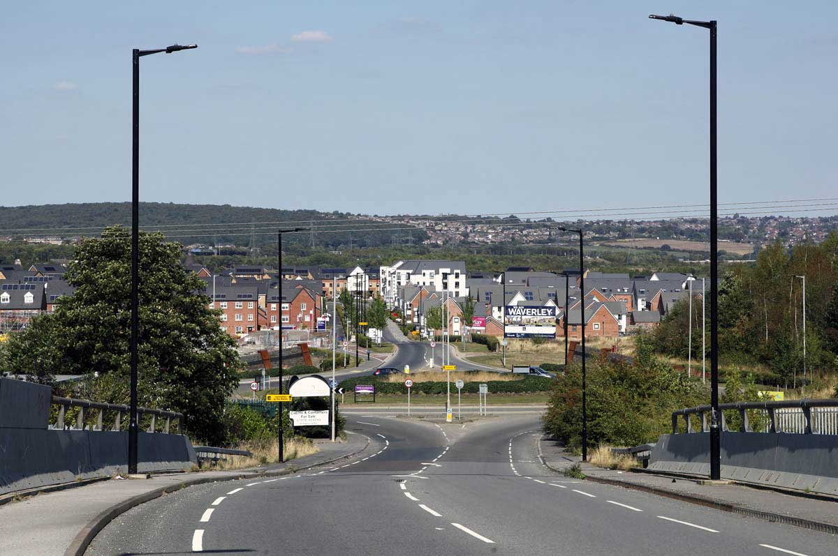
Waverley
looks like an attempt to build a semi-rural community with a high
tech future. Meanwhile the history of the First Industrial Revolution
is still manifest as the Orgreave Truth and Justice Campaign pushes
for an enquiry into the events of June 18th 1984 and,
nearby, Treeton village scores badly on socio-economic indicators of
well-being such as income, employment and health.
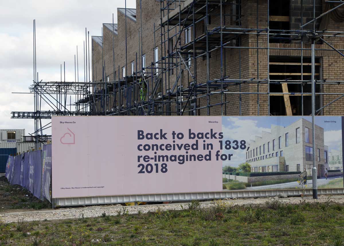 |
| Of all the appeals to Heritage that domestic house builders currently make, this has to be the most unlikely. |
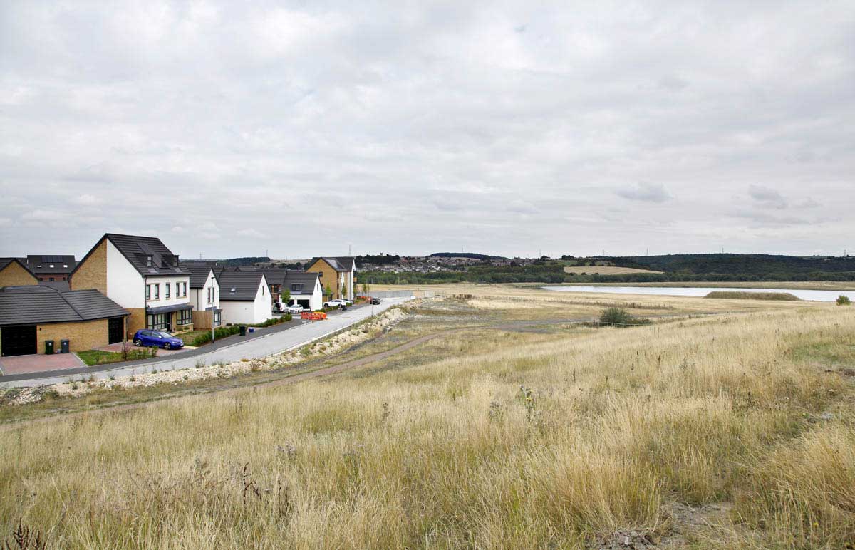 |
| The view over the Orgreave, now Waverley, site, 2018. Treeton village in the distance. A total of 4000 houses will eventually be built on the site. |
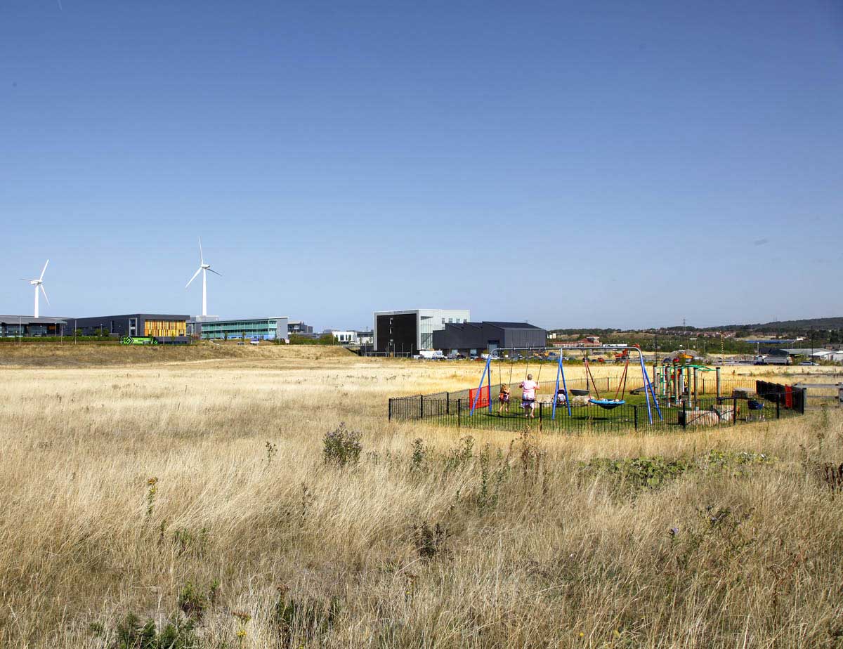 |
| The perimeter of the Waverley development looking to the Advanced Technology Park, 2018 |